


VTD-precinct BW- Webster-RacineTwp, Day County, South Dakota
About
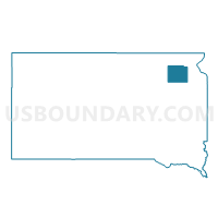
Outline

Summary
| Unique Area Identifier | 667238 |
| Name | VTD-precinct BW- Webster-RacineTwp |
| County | Day County |
| State | South Dakota |
| Area (square miles) | 70.44 |
| Land Area (square miles) | 61.44 |
| Water Area (square miles) | 9.01 |
| % of Land Area | 87.21 |
| % of Water Area | 12.79 |
| Latitude of the Internal Point | 45.36723170 |
| Longtitude of the Internal Point | -97.48808100 |
Maps


Graphs
Select a template below for downloading or customizing gragh for VTD-precinct BW- Webster-RacineTwp, Day County, South Dakota


Neighbors
Neighoring Voting District (by Name) Neighboring Voting District on the Map
- VTD-precinct 1 webster city ward 1, Day County, SD
- VTD-precinct 2 Webster ward 2, Day County, SD
- VTD-precinct 2 Webster-ward 3, Day County, SD
- VTD-precinct 3 Webster-ward 3, Day County, SD
- VTD-precinct 4 Webster ward 1, Day County, SD
- VTD-precinct 5 Waubay wards 1 & 2, Central Point-Egeland Twnshps, Day County, SD
- VTD-precinct 6 Waubay City Ward 3 and WaubayTwp, Day County, SD
- VTD-precinct BR- BristolCity-Bristo-KidderTwp, Day County, SD
- VTD-precinct FP Frm-Hmer-Ind-Unin-Lyn-PirpotTown, Day County, SD
- VTD-precinct GK-GrenvilleTown-Gren-KosciuskoTwp, Day County, SD
- VTD-precinct LT Sld-OG-Vy-Ty-Blr-Yk-Btltn-LilyTwn, Day County, SD
- VTD-precinct RR- Raritan-Liberty-Nutley-RoslynTwn, Day County, SD
- VTD-precinct RWRusk-Morton-Wheatland-Highland voting district, Day County, SD
Top 10 Neighboring County Subdivision (by Population) Neighboring County Subdivision on the Map
- Webster city, Day County, SD (1,886)
- Waubay township, Day County, SD (462)
- Webster township, Day County, SD (264)
- Rusk township, Day County, SD (118)
- Central Point township, Day County, SD (88)
- Grenville township, Day County, SD (84)
- Kidder township, Day County, SD (79)
- Racine township, Day County, SD (75)
- Raritan township, Day County, SD (75)
- Morton township, Day County, SD (70)
Top 10 Neighboring Place (by Population) Neighboring Place on the Map
Top 10 Neighboring Unified School District (by Population) Neighboring Unified School District on the Map
- Webster School District 18-4, SD (3,038)
- Waubay School District 18-3, SD (1,359)
- Roslyn School District 18-2, SD (735)
Top 10 Neighboring State Legislative District Lower Chamber (by Population) Neighboring State Legislative District Lower Chamber on the Map
Top 10 Neighboring State Legislative District Upper Chamber (by Population) Neighboring State Legislative District Upper Chamber on the Map
Top 10 Neighboring 111th Congressional District (by Population) Neighboring 111th Congressional District on the Map
Top 10 Neighboring Census Tract (by Population) Neighboring Census Tract on the Map
- Census Tract 9528, Day County, SD (2,109)
- Census Tract 9529, Day County, SD (1,919)
- Census Tract 9527, Day County, SD (1,682)